
A Holistic Framework for Stabilizing and Restoring areas impacted by Major Gully Erosion
Contact usStabilizing and Restoring areas Impacted by Major Gully erosionSURVEY, PLANNING AND DESIGN
This technical report details the implementation of erosion control measures to stabilize a severe dona formation located in the region between Nelspruit (Mbombela ) and Kaapschehoop, Mpumalanga Provance, South Africa.
The project addresses a significant erosion challenge in a donga with an average slope of 56% characterized by Reddish-Brown Clay soil, which is highly susceptible to erosion due to its fine particle composition and poor structural integrity.
Given the magnitude of the donga and its exposure to erosive conditions, a multi faceted strategy was implemented. This strategy includes the construction of:
- Contour Line Gabion Dissipartion Structure
- Length: 70 m
- Location: 20 m above the donga head
- Slope: 1:4 average
- Purpose: Disperse stormwater to prevent concentrated flow into donga
- Gabion Check Dam
- Primary Function: Stabalize the donga head and reduce slope
- Slope modification: Backfilling to achieve a 1:1.5 slope between donga head and check dam
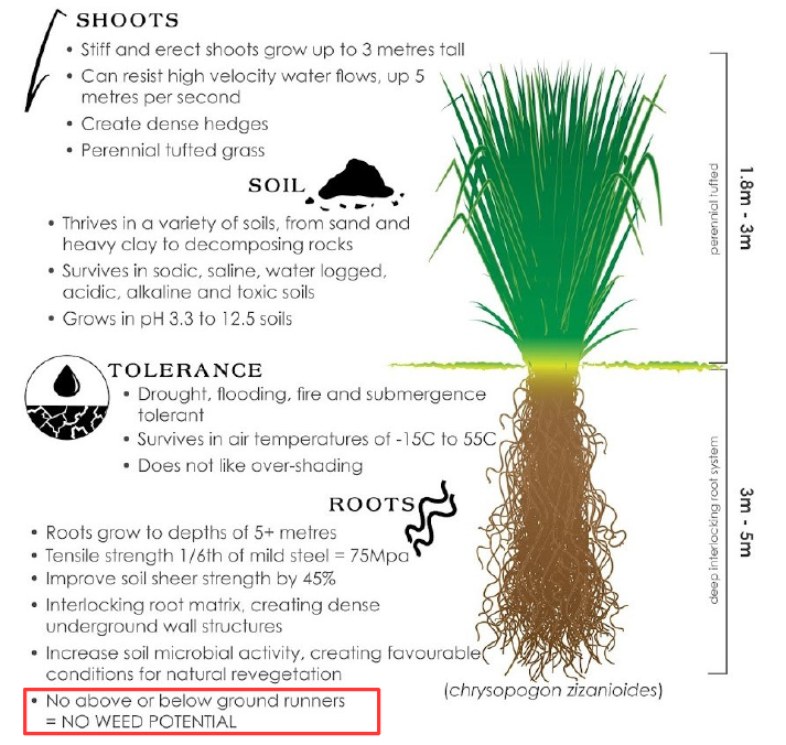
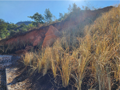
- Vegetation: Planting of Vetiver Grass
- Vertiver is known for its deep root system that helps in anchoring the soil and reducing erosion
- Silt Screens
- Strategically placed within the donga to retain sediment and facilitate a gradual reduction in the slope over time
Conclusion:
The combination of these measures aims to stabilize the donga head, reduce erosion, and promote sustainable land management in the area.
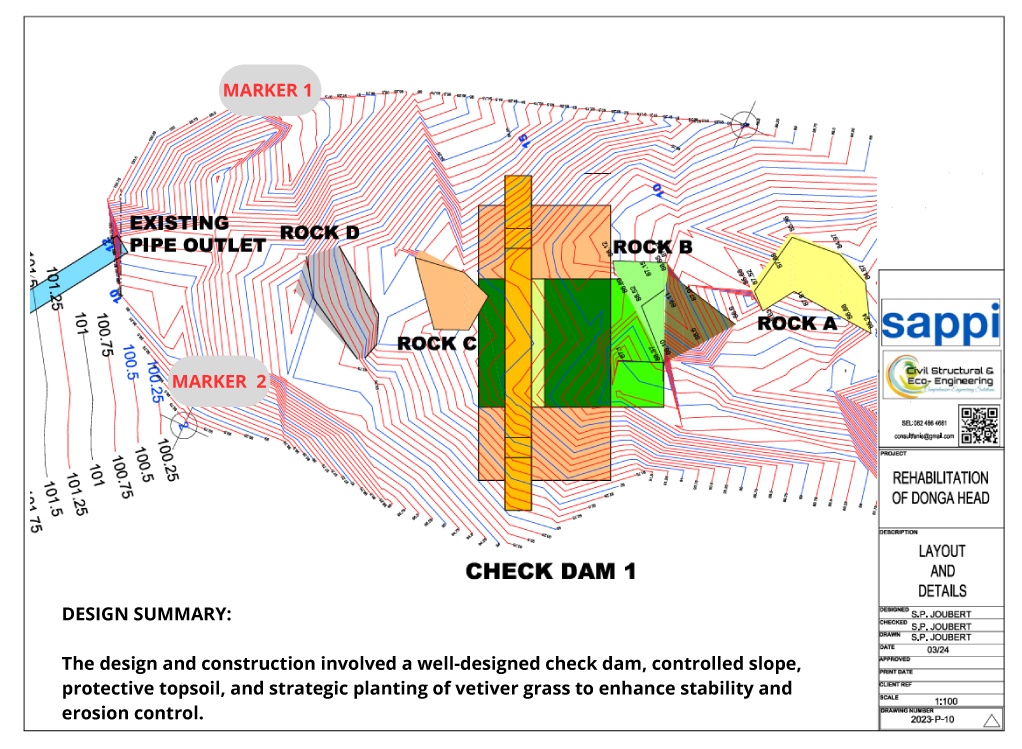
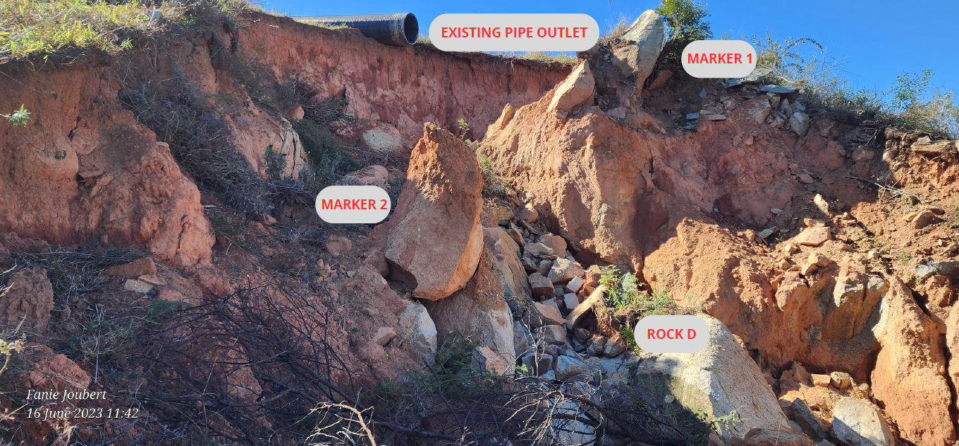


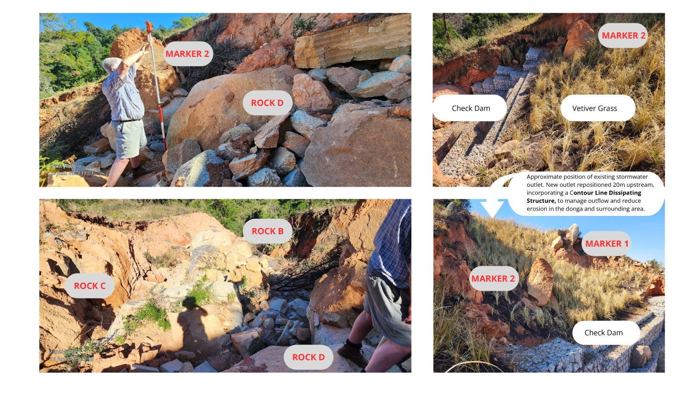
- Construction of a 3.6m High Check Dam
- A check dam with a heaght of 3.6 m was built
- The purpose of the check dam is to control water flow and prevent erosion
- The dam was strategically positioned to achieve specific goals.
- Slope Stability Considerations
- To maintain stability, the slope of the filling behind the check dam was carefully managed.
- The slope ratio was limited to 1:1.5 (vertical to horizontal).
- This ensures that the filling does not become excessively steep, minimising the risk of slope failure.
- Protective Topsoil Layer
- A final layer of topsoil was applied over the filling.
- This topsoil acts as a protective cover, preventing erosion and promoting vegetation growth
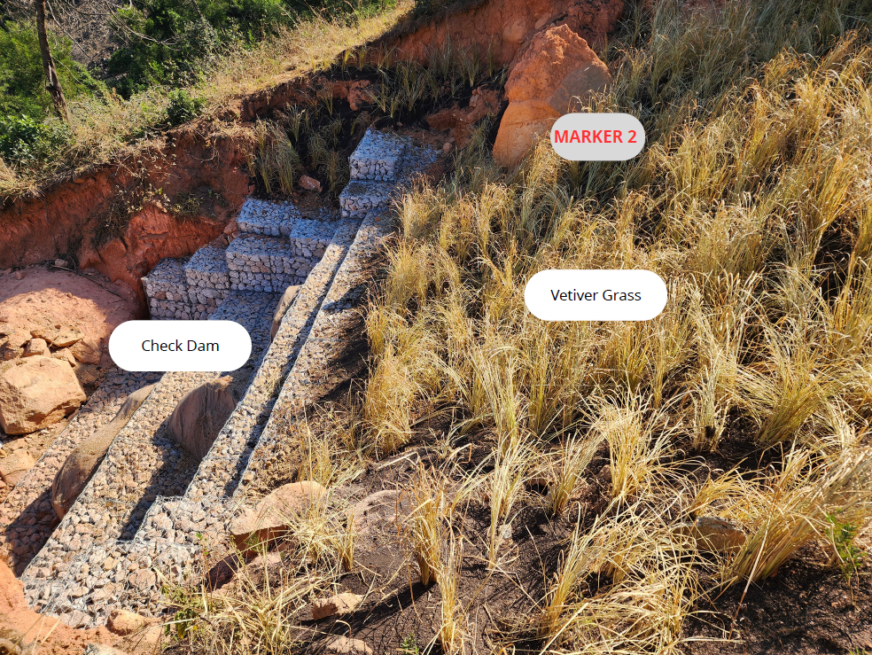
4.Vetiver Grass Planting
-
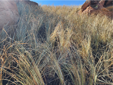
- Vetiver Grass (Chrysopogon zizanioides) was planted on the finished surface.
- Vetiver grass has deep roots that stabilise the soil, reducing erosion.
- It’s dense growth helps bind the soil particles together.
Contour Line Gabion Dissipation Structures

Have a site like this?
We can assess your slope, water, or wastewater issues and design a practical, proper solution.